I. Answer the following questions based on Bolstad Chapter 7 and lecture.
1. What are some advantages and disadvantages of using digital spatial data?
Advantages: Provides service information on "safety, health, transportation, water and energy." Required for disaster planning and management, national defense, infrastructure development and maintenance and government functions. Also pre-made data means you don't need to waste time making it. Disadvantages: Different governments specify different projections, data variables and attributes or have different requirements for survey accuracy or measurement units.
Advantages: Provides service information on "safety, health, transportation, water and energy." Required for disaster planning and management, national defense, infrastructure development and maintenance and government functions. Also pre-made data means you don't need to waste time making it. Disadvantages: Different governments specify different projections, data variables and attributes or have different requirements for survey accuracy or measurement units.
2. What are the most important questions you must ask before using already-developed spatial data?
Who Produced the Data? What requirements were used in creating the data? Is the data large or small scale? Does the data have what I need?
Who Produced the Data? What requirements were used in creating the data? Is the data large or small scale? Does the data have what I need?
3. How do DOQs differ from regular photographs?
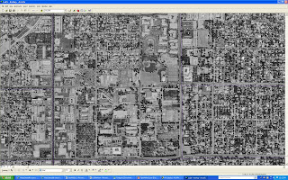
DOQ's are photos that have been altered to correctly represent an area or put it into a correct scale. Instead of leaving a raw photo that isn't spatially accurate.
DOQ's are photos that have been altered to correctly represent an area or put it into a correct scale. Instead of leaving a raw photo that isn't spatially accurate.
4. Choose three existing data sets and describe who produces them, what the source materials are and what they contain.
(1) Global Map. Produced by: Global Spatial Dataset Infrastructure. Source Material: Many countries contribute in giving information to make this data set. Contains: Boundaries, elevation, land cover and drainage. (2) National Hydrologic Data. Produced by: EPA and USGS. Source Material: USGS digital line graph data and EPA river data. Contains: Natural occurring and built features concerning water bodies (streams, dams, lakes) (3) National Atlas. Produced by: USGS. Source Material: 20 federal agencies. Contains: Political boundaries, environmental features, climate, history, biology, natural hazards.
(1) Global Map. Produced by: Global Spatial Dataset Infrastructure. Source Material: Many countries contribute in giving information to make this data set. Contains: Boundaries, elevation, land cover and drainage. (2) National Hydrologic Data. Produced by: EPA and USGS. Source Material: USGS digital line graph data and EPA river data. Contains: Natural occurring and built features concerning water bodies (streams, dams, lakes) (3) National Atlas. Produced by: USGS. Source Material: 20 federal agencies. Contains: Political boundaries, environmental features, climate, history, biology, natural hazards.
5. What is the difference between DEMs and NEDs?
DEMs or Digital Elevation Models are raster data and have course resolution. They cover small areas with fixed boundaries that, if a larger area is needed, they have to be pasted together. NEDs (National Elevation Dataset) on the other hand are the highest resolution and seamless. Since DEMs came around they have removed the errors from the DEMs.
DEMs or Digital Elevation Models are raster data and have course resolution. They cover small areas with fixed boundaries that, if a larger area is needed, they have to be pasted together. NEDs (National Elevation Dataset) on the other hand are the highest resolution and seamless. Since DEMs came around they have removed the errors from the DEMs.
II. Step through the following instructions and answer any associated questions.
2.
a) Basemap and Hydrology
b-c) NHDFlowline (line), NHDPoint (point), NHDWaterbody (polygon), Watersheds (polygon)
3.
a) Vector
b)SHP
c)yes
d)ArcGIS Geodatabase
e) yes
f) Hydrology, US, Artificial Path
g) Earth Science Information Center, USGS
4. a) Yes
6. b) 34118-B5
7. Black and White
12. Red exclamation point and gray checkmark


